|
|
Moab, Utah:
|
|
|
|
||
|
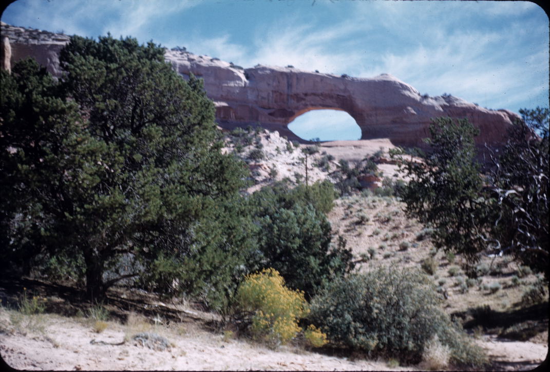
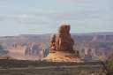
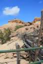
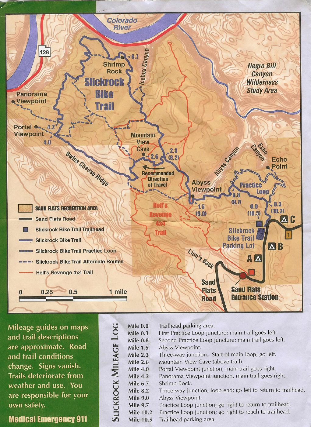
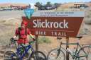
March 2008 - PlanningI have never really been to Moab, Utah (save when I was two; that's where the picture of Wilson Arch came from). Now I am going with a different goal than my Mom and Dad, a reason that didn't really exist in 1958—mountain biking. If fact since then the park has been enlarged by three different Presidents (Eisenhower in 1960, Johnson in 1969, Clinton in 1998) and it was transformed from a National Monument to a National Park (Nixon in 1971) 1. Now Moab, Utah is presumably the ultimate mountain bike riding area in the United States. Online maps (see below) show a couple hundred miles of trails for mountain bikes, hikers, ATVs and four wheel drives. Odd combination but both have a love for the wilderness and rock. We, my youngest and I, will be going for the first week in April in hopes of avoiding the tourists and getting some hot dry weather as a good introduction to spring. But we may only meet the latter of those goals since (somewhere on the web I read that) April/May and September/October are the busiest months of the season—at least for mountain biking. This was confirmed when I went to reserve the campsite and found the Devil's Garden Campground nearly full. I am not willing to risk the "walk up option". The pictures below show the Devil's Garden Campground which was well appointed (lacking showers) and is clean and quiet. After returning I found a list of other places to camp. The maps noted above have most of them marked. The weekend prior to our arrival was Jeep Safari weekend in Moab. From the sounds of things, room anyplace was hard to find. Prior to visiting looking at the information center's event list may help you miss (or, hit) the big events. For both of us, this will the first time ever going out on a multi-day "big adventure" with the sole purpose of trying not to kill ourselves on rocks that far from home. My goal is to get him hooked the "road warrior" trip to a vacation fun spot, play hard, relax sightsee and head home. Having never been there, this is more of an introductory blog for the planning end and then after we get back a repository of tales, tips and pictures. If you have never been to Moab the first thing you need to do is figure out where it is. Next is to start looking at some maps to determine what makes sense. Both the National Park Service and the Moab Utah Information Site are valuable sources of data. The keys are the maps for the trails: .jpg)
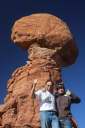
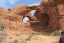
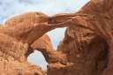
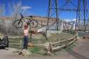
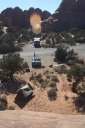
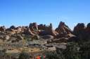
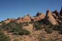
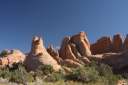
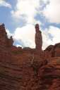
Google Earth, which my son prefers, can be used to explore the site if you are interested, but I am "old fashion" and prefer simple Satellite imagery (in this case Yahoo's). The image to the right is a composite image that I created from Yahoo Maps; I superimposed the Arches and Canyonlands boundaries (traced from the NPS maps) and have labeled a few interesting points. The TripThe problem upon return is to figure out how to make this a "bike thing", since it ended up being a "bike-hike-photography thing". As you can tell by our picture at the top of this dissertation, it was a two thumbs up trip. Because of this I have decided to start with some the photos, they alone should summarize the Wow-factor of the trip.
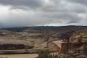
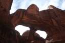
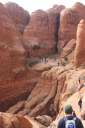
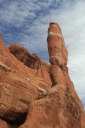
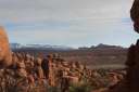
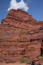
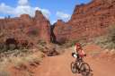
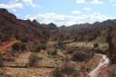
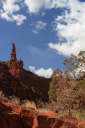
The above pictures are an attempt to show the parks, the size and the depth but I can only say you will be in awe when you get there. Pictures simply do not do the sights justice and you will end up forgetting about the bikes as you wonder the trails in the parks (which are off limits to bikes). In fact, the parks are not the best places to ride your mountain bike and I would recommend a road bike for the primary roads in the parks. The dirt roads in Arches are better traveled by car since there destinations are nice but the real value is in hiking the trails at the destination. On the other hand, The Canyonlands, Island in the Sky district has a "perimeter" road called the White Rim Road. The road is named after the layer of rock that it tends to follow in the district. This road is about 110 miles in length and would be a wonderful two or three day ride (I would guess there are races that do it in a day, but my goal is to enjoy the scenery and you will have an eye full on this trip). You will need to pack a couple gallons of water per person and be ready for some real hills. We talked to people that did 30 miles of this in a car and it took 3 hours. If it rains you could get stuck for a couple days since most maps warn of impassible sections when wet.
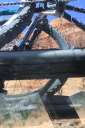
Oh, yes, the trip... Yes, we had two cameras (actually three when you count the point and shoot). Yes, we had 5 GB of storage. Yes, I rode my bike. No, Garrett took no pictures of me doing so.
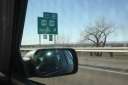
28-Mar-2008 The projected ten-day weather forecast was not as hot as I wanted but the 65-75 degree weather should be better than what was here. The week had threatened snow and on our day to leave... well... look for yourself. When we were all packed and ready to go, the weather was not cooperating... except for a great parting shot of us in the hail. The distance to Moab would end up being almost an even 1000 miles.
29-Mar-2008
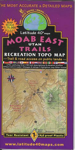
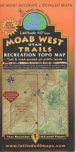
30-Mar-2008 We also bought the two Moab trail maps developed by Latitude 40 Maps at the Arches Visitor Center. These maps are available from Latitude 40 or a multitude of other places in Moab and the visitor's centers in the parks. They are strongly recommended. Besides the obvious safety feature of having a map when in the back country, these maps have descriptions of the trails and who can use the trails. Many trails are off limits to mountain bikes or other vehicles and some have restrictions based on weather. Although not all trails are mentioned, key one's are and this gives you enough detail to plan your trip.
If this is your first trip to Moab, you will probably also need some orientation time. We were looking for both technical and scenic aspects of the trails and the latter are in the eye of the beholder and are not easy to pick up from the maps. Driving around will get most of the qualitative data you need to finalize your plans. |
||||||||||||||||||||||||||||||||||
|
31-Mar-2008
01-Apr-2008 
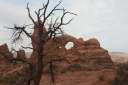
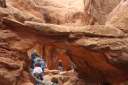
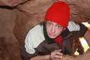
The route is tough and I took the practice loop twice and still had issues with the full trail. I never did get through the entire loop. Garrett did much better and was probably frustrated that the old man could not keep up. The two sequences are Mr. G. having some fun. We took the National Park Service tour of Fiery Furnace. This is a short hike and a great photo session. The cost is $10 a head and well worth the price for your first entrance. After that you can get a back country permit (same price) and explore on your own. I would highly recommend the guided tour first, you will spend forever trying to find the neat spots they take you. You can always go back for your own exploring later.
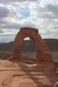
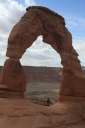
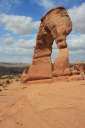
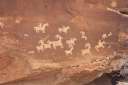
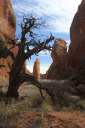
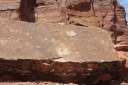
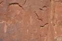
02-Apr-2008 If you are camping, there are a number of places to get showers. As well as buying tubes, tires and a souvenir or two, we used the showers at Poison Spider Bicycles. The showers were a god send after a couple of days of riding, even in the cool weather that we had. They are about a dollar a minute in 2.5 minute increments. Knowing we were running out of time and wanted to see more of the sights, we drove down Highway 279 on the north side of the Colorado toward Potash. this would be a great bike road and takes past numerous petroglyphs and one set of dinosaur prints. To close out our day we hiked up to Landscape Arch in the Devil's Garden. This is a short 1.5 mile round trip hike.
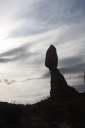
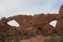
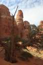
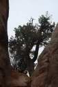
03-Apr-2008 After conquering Onion Creek we drove to The Needles district of the Canyonlands. This area of the park was more inhabited by Native Americans and has a number of hiking trails. We did no biking here. For a set of sunset pictures we drove to Klondike Ridge and did the two mile hike to Tower Arch
04-Apr-2008 and 05-Apr-2008 |
||||||||||||||||||||||||||||||||||
|
What I would do differentFor my first trip I was very pleased with how this all worked out. I may not have done as much biking as I would have liked, but I cannot say we had idle time. For bicycling, the Devil's Garden Campground is a bit out of the way, but it is clean quite and has running water. I might look a little closer at the available campgrounds for one that might be out of the park and more centrally located. My concern would be dust and noise. Both well controlled at the Devil's Garden. As for trips, well, there is a list...
|
||||||||||||||||||||||||||||||||||
.jpg)
.jpg)
.jpg)
.jpg)
.jpg)
.jpg)

.jpg)
.jpg)
.jpg)


.jpg)
.jpg)